


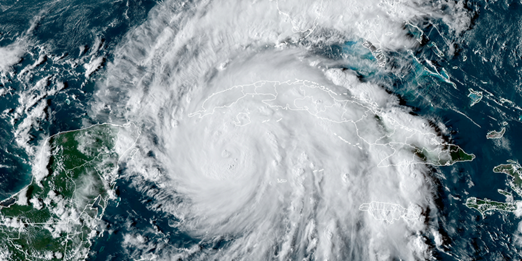
The Eastern Pacific hurricane season began on May 15, and the Atlantic hurricane season starts on June 1. The National Hurricane Center issued its first daily tropical weather outlook of the year on Thursday, but what does that mean? FOX Weather Meteorologists Marissa Torres and Jane Minar take a look at how those bulletins work to keep you informed of potential tropical activity.
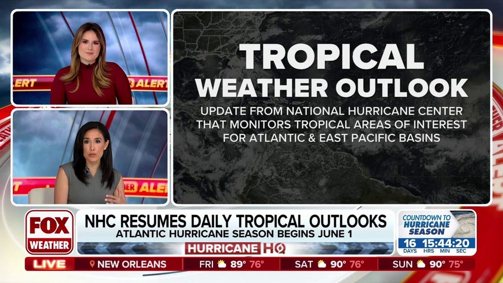
The National Hurricane Center (NHC) has started issuing its daily tropical weather outlooks to provide crucial information on potential tropical activity, but what does all of that information mean?
FOX Weather is here to help break down the information and present it in a way that’s easier to understand, so you and your family can prepare and stay safe.
2025 ATLANTIC HURRICANE SEASON GUIDE: HERE’S WHAT TO KNOW ABOUT THE TROPICS THIS YEAR
When does hurricane season start?
Hurricane season runs from June 1 to Nov. 30 in the Atlantic Basin, which is where most hurricanes that affect the U.S. originate.
However, the U.S. can also be impacted by tropical storms and hurricanes from the Eastern Pacific, where hurricane season begins May 15 and runs until Nov. 30.
LIVE HURRICANE TRACKER MAPS
What is a tropical weather outlook from the NHC?
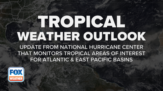
This graphic explains the meaning of a tropical weather outlook.
(FOX Weather)
A tropical weather outlook that’s issued by the NHC is simply an update that monitors tropical areas of interest for the Atlantic and Eastern Pacific basins.
“You’ll probably see a lot of these outlooks pretty much every day going forward here,” FOX Weather Meteorologist Jane Minar said.
HOW ARE HURRICANES RATED? THE SAFFIR-SIMPSON HURRICANE WIND SCALE EXPLAINED
What time does the tropical weather outlook come out?
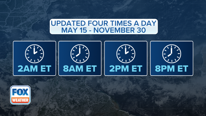
This graphic explains when the tropical weather outlooks are issued.
(FOX Weather)
The NHC issues its tropical weather outlook several times a day: 2 a.m., 8 a.m., 2 p.m. and 8 p.m. EDT.
When we change to standard time in November, those outlooks are issued at 1 a.m., 7 a.m., 1 p.m. and 7 p.m. EST.
WHY IS THE RIGHT SIDE OF A HURRICANE MORE DANGEROUS?
What is a tropical weather outlook map?
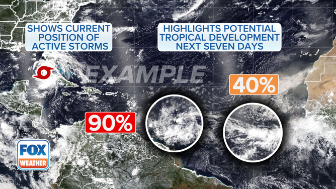
This graphic provides an example of a tropical weather outlook map.
(FOX Weather)
A tropical weather outlook map shows a broad view of the Atlantic and Pacific basins and will highlight two things: the current positions of any active storms and any areas of interest with their chances of development.
“When there’s an area that the (NHC) is monitoring, we call that a disturbance,” Minar continued. “We are going to highlight that, and then you’ll see the percentages put on them. And we’ll be looking at this over the next five to seven days, right? The possible development of these (systems).”
HOW TO WATCH FOX WEATHER
What do the colors mean on a map showing a potential tropical disturbance?
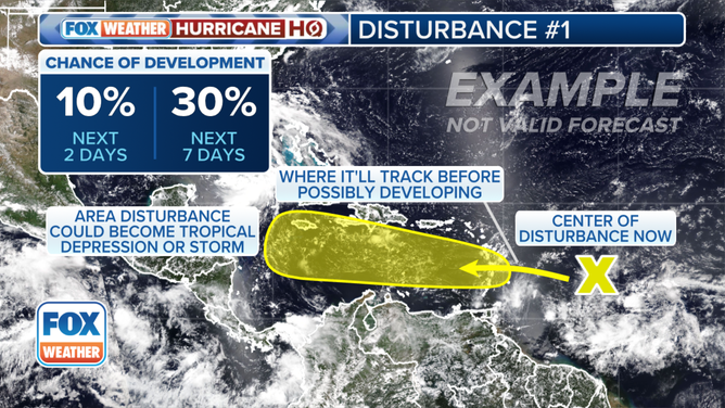
This graphic shows the chances of tropical development and where it could develop.
(FOX Weather)
As soon as forecasters believe there could be trouble brewing, they will provide more in-depth information about where the potential tropical depression, tropical storm or hurricane could form and where that could happen.
“Notice the color coding,” FOX Weather Meteorologist Marissa Torres said. “You’ll start to see this. And that ‘X’ marking where we have a disturbance.”
DOWNLOAD THE FREE FOX WEATHER APP
The NHC notes when a tropical disturbance has a low (less than 40%), medium (40-60%) and high (more than 60%) chance of developing over the next two to seven days.
“So, before it becomes anything fully formed, it’s really just an area of disturbed weather,” Torres continued. “That’s where ‘X’ marks the spot. And then that little jelly bean of yellow, which will eventually become orange, the color change has to do with the odds going up of it developing into a tropical system.”
And within that shaded area, that’s where it would likely develop.
“And it could be anything from a tropical depression to a tropical storm to a hurricane,” Minar said. “And oftentimes, once we get into the red colors, that means, ‘Okay, we mean business.’”
From there, an “invest” would be designated.
WHAT IS STORM SURGE?
What is an ‘invest’ during hurricane season?
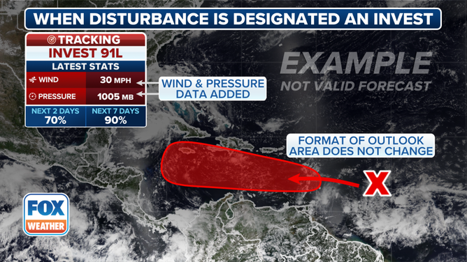
This graphic shows information when a disturbance is designated an invest.
(FOX Weather)
The term “invest” is simply a naming convention used by the NHC to identify areas forecasters are investigating for possible development into a tropical depression or tropical storm within the next seven days.
It’s used every hurricane season in the Atlantic and the Eastern and Central Pacific basins, accompanied by a number from 90 to 99 and either the suffix “L” (Atlantic), “E” (Eastern Pacific) or “C” (Central Pacific). Once we reach 99, we’ll return back to 90.
On the map, details about the invest are included, like the maximum sustained winds, the central pressure and the chances of development over the next two to seven days.